Kilauea is one of the most active volcanoes on Earth, and "is it erupting right now?" is the single most common question people ask before planning a Big Island trip. The honest answer changes often. This page tracks the current status, explains what an eruption at Kilauea actually looks like in 2026, and shows you where to stand to see it.
Current Kilauea status
The status above is sourced from the U.S. Geological Survey Hawaiian Volcano Observatory (HVO), which monitors Kilauea around the clock with a network of seismometers, GPS stations, tiltmeters, gas sensors, and thermal cameras. We pull the latest HVO update automatically every day, so the banner above stays current without human intervention. If you're driving to the park specifically to see lava, always confirm the latest USGS update on the morning of your visit. Need just the status without the full guide? Use our live Kilauea status widget (also embeddable on your own site).
What "erupting" actually means at Kilauea
In the public imagination, an erupting volcano means rivers of lava flowing toward the ocean. That kind of activity, the long-running Puʻu ʻŌʻō eruption from 1983 to 2018, ended after the dramatic 2018 lower Puna eruption reshaped the lower East Rift Zone. Since 2020, Kilauea's activity has shifted back into its summit caldera.
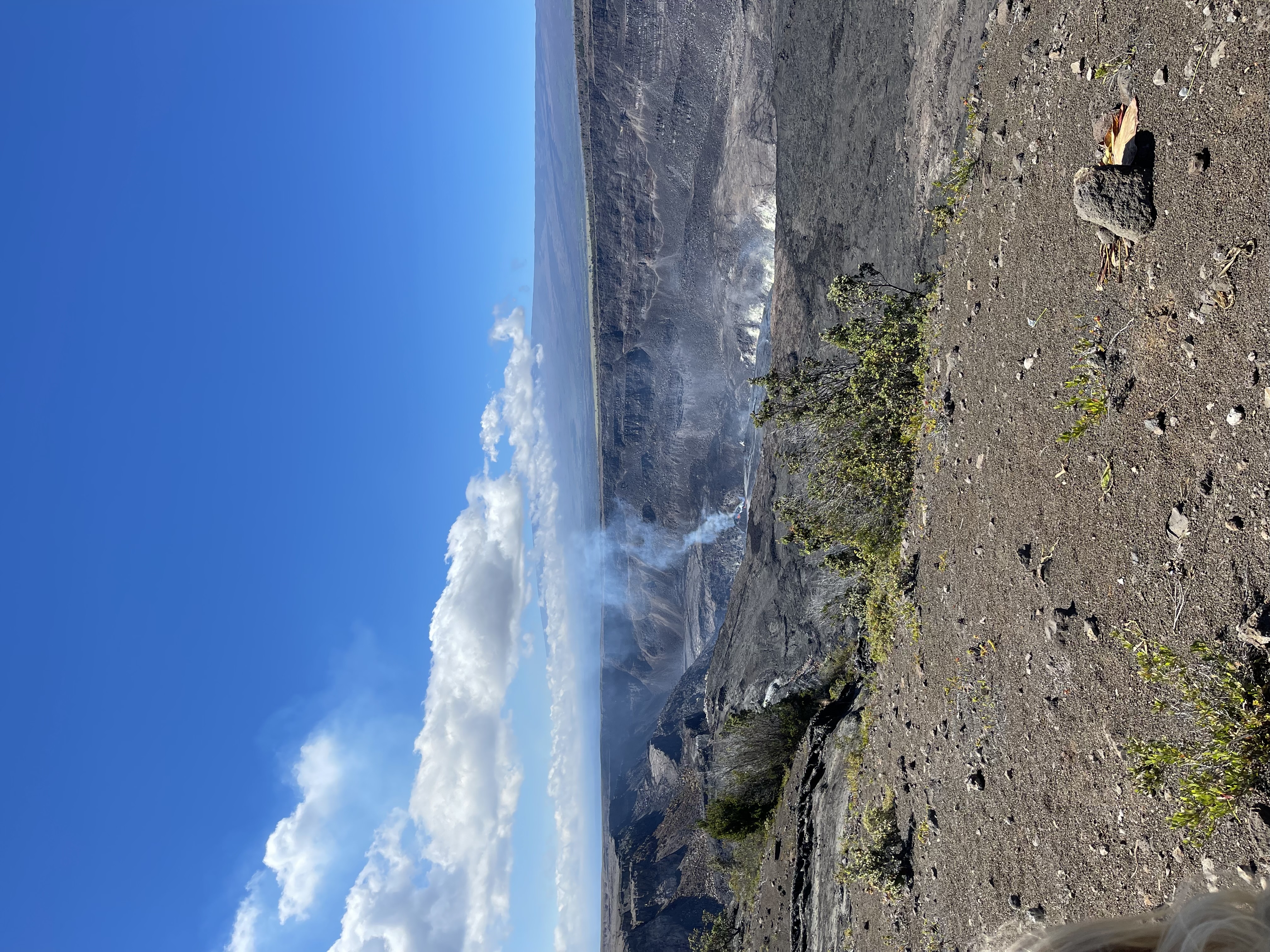
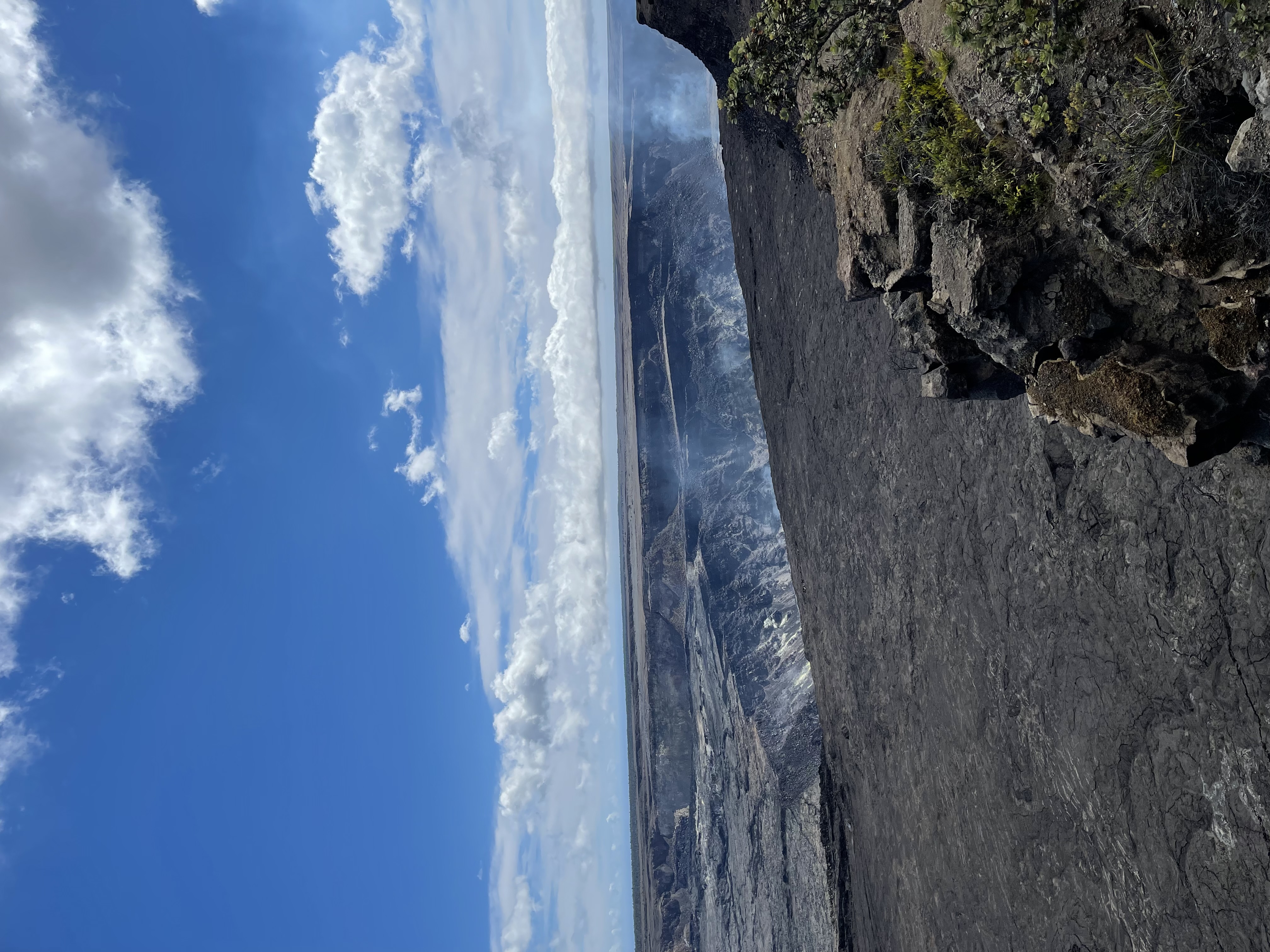
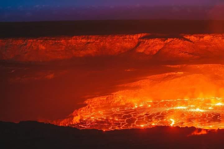
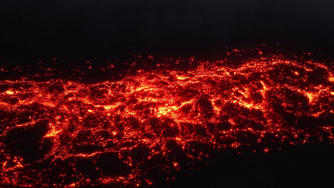
Modern Kilauea eruptions typically take place inside Halemaʻumaʻu crater at the summit. They're often described as effusive or episodic: lava fountains and a churning lava lake confined within the crater, visible from designated overlooks on the rim. Recent episodes in 2024–2025 produced spectacular fountains for hours at a time, separated by quiet days between events.
USGS publishes a four-level Volcano Alert Level:
- Normal: Typical background activity.
- Advisory: Elevated unrest above known background.
- Watch: Heightened or escalating unrest, or an eruption is underway with limited hazards.
- Warning: Hazardous eruption is imminent, underway, or suspected.
Most of Kilauea's recent summit eruptions have stayed at the Watch level because they pose little hazard outside the closed area inside the caldera.
Where to safely see Kilauea activity
Hawaiʻi Volcanoes National Park keeps designated viewing areas open during most summit eruptions. The best vantage points depend on wind, gas concentrations, and which side of Halemaʻumaʻu is most active on any given day. Rangers reposition closures frequently, so always check the park's current alerts at the entrance station.
Common overlooks that are open during summit eruptions:
- Kilauea Overlook: Closest west-rim view, often the best after-dark glow when the wind is favorable.
- Wahinekapu (Steaming Bluff): A short walk from the parking area; gives a wider angle on the caldera.
- Keanakākoʻi Overlook: A roughly 1-mile round-trip walk on closed road, often the best south-side view of fountaining.
- Uēkahuna: The former Jaggar Museum site, with the highest summit-rim perspective.
The glow is most visible at dawn and after sunset, when contrast with the surrounding caldera is highest. Bring layers; the summit sits at about 4,000 feet of elevation and gets cold and windy after dark, even in the middle of a Kona-side heat wave.
Live webcams and official feeds
Three sources reliably tell you what Kilauea is doing in the last few minutes, no matter where you are in the world:
- USGS HVO Kilauea page: usgs.gov/volcanoes/kilauea publishes the daily update and current alert level.
- USGS HVO webcams: Live thermal and visual webcams inside and around the caldera. The thermal cam reads activity even at night and through vog.
- National Park Service alerts: nps.gov/havo posts road, trail, and overlook closures in near real time.
Recent Kilauea eruption history
A quick reference for the most-asked-about recent activity:
- 1983–2018: Puʻu ʻŌʻō eruption on the East Rift Zone, one of the longest-running eruptions in modern record. Ended with the 2018 lower Puna eruption and caldera collapse.
- 2018: Lower East Rift Zone eruption destroyed hundreds of homes in Leilani Estates and built new coastline at Kapoho. Summit caldera floor dropped roughly 1,600 feet.
- 2020–2023: Multiple intermittent summit eruptions inside Halemaʻumaʻu, mostly confined lava lakes.
- 2024–2025: Series of episodic summit eruptions with dramatic lava fountains, separated by multi-day pauses. Drew large visitor crowds to the park's overlooks.
Visiting with a private guide
Self-driving to Hawaiʻi Volcanoes National Park works well for visitors already staying on the east side of the Big Island. From the Kona and Kohala resort coasts, the round-trip is a long, dark drive that often starts before dawn or ends well after sunset, exactly when the volcano is most photogenic.
A private chauffeured tour solves three things at once: a driver who knows the road, real-time intel on which overlooks are open, and the flexibility to stay through dusk for the glow without anyone watching the clock. Pricing is per vehicle, not per person, which makes private guiding competitive for couples and families compared to large group coaches.